wanderland.ch/en veloland.ch/de mountainbikeland.ch/en skatingland.ch/en kanuland.ch/en slowup.ch

???accessibility.header.mainContent???

Home Home
    • D
    • F
    • I
    • E
???structural.subnavigation???
  • Project information
  • Newsletters
  • Manuals
  • Infrastructure
  • Route indicators
    • ???nav.selected???Hiking in Switzerland
      • International routes
      • National routes
      • Regional routes
      • Local routes
    • Cycling in Switzerland
    • Mountainbiking in Switzerland
    • Skating in Switzerland
    • Canoeing in Switzerland
    • Winter hiking
    • Snowshoe trekking
    • Cross-country skiing
  • Logos / Pictograms
  • Accommodation
  • Monitoring
  • Media
  • Data delivery
  • Protected area

SwitzerlandMobility Foundation

Hiking in Switzerland route indicators

Downloads

???nav.selected???
  1. Home
  2. Download
  3. Route indicators
  4. Hiking in Switzerland

Hiking in Switzerland route indicators

International routes

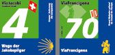
Hiking in Switzerland route indicators: international routes

National routes

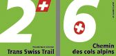
Hiking in Switzerland route indicators: national routes

Regional routes

Hiking in Switzerland route indicators: regional routes

Local routes

Hiking in Switzerland route indicators: local routes

???structural.navigation???
  • History
  • Organisation
  • SwitzerlandMobility partners
  • slowUp partners
  • Contact
  • ???nav.selected??? Download

© 2009 Stiftung SchweizMobil

Powered by Magnolia - Open-Source Content Management System